


READING TWP VTD 01, Adams County, Pennsylvania
About
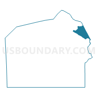
Outline

Summary
| Unique Area Identifier | 655634 |
| Name | READING TWP VTD 01 |
| County | Adams County |
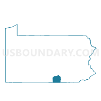
| State | Pennsylvania |
| Area (square miles) | 10.07 |
| Land Area (square miles) | 9.81 |
| Water Area (square miles) | 0.25 |
| % of Land Area | 97.47 |
| % of Water Area | 2.53 |
| Latitude of the Internal Point | 39.97005460 |
| Longtitude of the Internal Point | -77.01044790 |
Maps

Graphs
Select a template below for downloading or customizing gragh for READING TWP VTD 01, Adams County, Pennsylvania


Neighbors
Neighoring Voting District (by Name) Neighboring Voting District on the Map
- EAST BERLIN Voting District, Adams County, PA
- LATIMORE TWP Voting District, Adams County, PA
- PARADISE TWP Voting District, York County, PA
- READING TWP VTD 02, Adams County, PA
- WASHINGTON TWP Voting District, York County, PA
Top 10 Neighboring County Subdivision (by Population) Neighboring County Subdivision on the Map
- Reading township, Adams County, PA (5,780)
- Paradise township, York County, PA (3,766)
- Washington township, York County, PA (2,673)
- Latimore township, Adams County, PA (2,580)
- East Berlin borough, Adams County, PA (1,521)
Top 10 Neighboring Place (by Population) Neighboring Place on the Map
Top 10 Neighboring Unified School District (by Population) Neighboring Unified School District on the Map
- Spring Grove Area School District, PA (27,384)
- Dover Area School District, PA (25,748)
- Bermudian Springs School District, PA (13,105)
Top 10 Neighboring State Legislative District Lower Chamber (by Population) Neighboring State Legislative District Lower Chamber on the Map
- State House District 196, PA (69,920)
- State House District 92, PA (68,932)
- State House District 193, PA (67,435)
Top 10 Neighboring State Legislative District Upper Chamber (by Population) Neighboring State Legislative District Upper Chamber on the Map
Top 10 Neighboring 111th Congressional District (by Population) Neighboring 111th Congressional District on the Map
Top 10 Neighboring Census Tract (by Population) Neighboring Census Tract on the Map
- Census Tract 308, Adams County, PA (7,451)
- Census Tract 203.20, York County, PA (7,447)
- Census Tract 301.02, Adams County, PA (5,780)
- Census Tract 205.10, York County, PA (3,766)
- Census Tract 301.01, Adams County, PA (2,580)